Across organizations including Brockmann Geomatics and ICEYE, I have built scalable data pipelines, automated validation frameworks, and machine learning solutions supporting disaster response, infrastructure monitoring, and operational analytics. My expertise spans Python, SQL, machine learning, time-series analysis, geospatial analytics, and Generative AI, with growing focus on cloud technologies and MLOps.
I am particularly passionate about solving meaningful problems at the intersection of data science, AI, and Earth observation, whether for environmental sustainability, climate applications, business analytics, or scientific computing.
Download my detailed CV. I am always open to interesting projects, collaboration opportunities, and new challenges. GET IN TOUCH.
Interests
- Data Science & Machine Learning
- Earth Observation & Satellite Analytics
- Geospatial Data Engineering
- Scientific Software Engineering
- Time-Series Analysis & Forecasting
- Artificial Intelligence & Generative AI
- Python Development & Automation
- Cloud & MLOps
- Environmental Intelligence
- Research Software Engineering
- Decision Support Systems
- Scalable Data Pipelines
Education
Master of Engineering in Remote Sensing and GIS, 2019
Indian Institute of Remote Sensing (ISRO), India
Post Graduate Diploma in Biomedical Instrumentation and Informatics, 2017
CDAC, India
Bachelor of Engineering in Electronics and Communication, 2016
Rajasthan Technical University, India
Experience
My professional work experience
Data Scientist
Brockmann Geomatics Sweden AB
Designing and maintaining production-grade Python workflows and machine learning solutions for environmental, water, and climate analytics. Integrating multi-source geospatial and Earth observation datasets into reproducible, decision-ready products for major international initiatives including OASIS (Horizon Europe) and AQUATIME (European Space Agency). Strong emphasis on scientific software engineering, data quality, validation, and traceability. (Python, SQL, GeoPandas, GDAL, Rasterio, MLflow, Git, Linux).
Key Professional & Technical Skills
- Data science & applied AI
- Earth observation analytics
- Scientific software engineering
- Machine learning workflows
- Time-series analysis
- Environmental & water analytics
- Python, SQL, GIS tools
- Validation & reproducibility
- Horizon Europe projects
SAR Remote Sensing Engineer
ICEYE Oy
SAR data processing, geospatial analytics, insight product development, and environmental monitoring using remote sensing. Workflow automation, change detection, trend analysis, and statistical modeling for crisis response. Visual reporting and spatial outputs for decision support. (Python, SAR, QGIS, ArcGIS, GDAL, Power BI).
Key Professional & Technical Skills
- Remote sensing analytics
- Geospatial data science
- Operational product delivery
- Disaster intelligence workflows
- Data pipeline engineering
- Stakeholder collaboration
- Python, SAR, GIS tools
- Cloud & API integration
- Scientific reporting
Geospatial Data Analyst
Freelance
Remote Sensing & GIS Researcher
Delft University of Technology
Jr. Remote Sensing & GIS Researcher
Indian Institute of Technology
Education
Academic foundation and professional qualifications
Master of Engineering in Remote Sensing and GIS
Post Graduation Diploma in Bio-Medical Instrumentation & Health Informatics
Bachelor of Engineering in Electronics & Communication
Education, Courses & Certifications
Academic degrees, professional courses, certifications, hackathons, and conference participation
Courses & Certifications
An interdisciplinary learning path spanning remote sensing, data science, version control, and project management. These certified courses expand my technical fluency, coding confidence, and team-oriented delivery practices—shaping a well-rounded professional profile.
Conferences
A showcase of workshops and hackathons that amplified my expertise in LiDAR, machine learning, geospatial intelligence, and entrepreneurship—focusing on real-world data challenges and interdisciplinary teamwork in forestry and environmental domains.
Skills
Capabilities built through cross-domain work in geospatial analytics, AI, and scientific software delivery
Projects
Selected projects spanning Earth observation, geospatial intelligence, and AI-enabled analytics
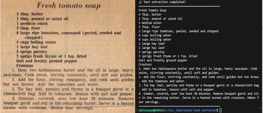
Vision Text Extractor
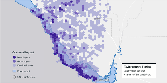
ICEYE Hurricane Solution
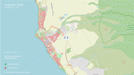
ICEYE Wildfire Insights
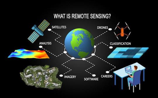
Remote Sensing Applications
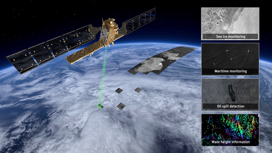
SAR Techniques and Fundamentals
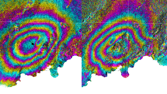
InSAR Applications
Publications
Peer-reviewed and conference contributions in remote sensing, geospatial analytics, and Earth observation
Updates
Recent milestones, publications, and professional highlights
What’s New & Updates
Stay updated with my latest professional journey, project announcements, and insights from the world of geospatial analytics and remote sensing.
What’s Been Done & Past Achievements
Explore my professional foundation and past accomplishments that shaped my expertise in geospatial analytics, remote sensing, and emerging technologies. A comprehensive look at completed courses, hackathons, publications, and skill development milestones.
Contact
Open to collaborations, consulting opportunities, and research conversations
- udit.asopa@gmail.com
- +358-403515447
- Kuusikallionkuja 3, Espoo, Uusimaa 02210