InSAR Applications
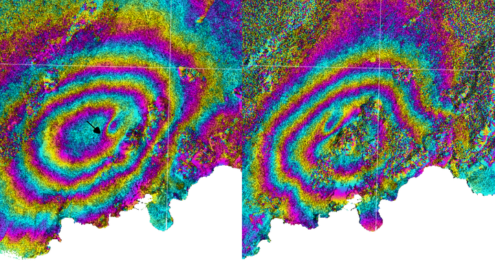
Isn’t it fascinating how Earth observation technologies are continually enhancing our ability to analyze and interpret the planet’s dynamics? Among these, Interferometric Synthetic Aperture Radar (InSAR) stands out as a remarkably powerful technique. It enables the detection of minute surface displacements with centimeter- to millimeter-level accuracy across extensive areas, making it a vital tool for monitoring natural hazards, infrastructure stability, and environmental changes.
My interest lies in leveraging SAR data, particularly interferometric SAR, to uncover the subtle movements and transformations occurring on Earth’s surface. My work in InSAR has involved both the analytical interpretation of methodologies and their application to a range of practical, real-world challenges.
Achievements:
- Published in ISPRS Annals of the Photogrammetry, Remote Sensing and Spatial Information Sciences, Volume IV-5 | ISPRS TC V Mid-term Symposium Geospatial Technology – Pixel to People (2018)
- Published in 2nd International Electronic Conference on Geosciences (2019)
- Published Abstract in American Geophysical Union Fall Meeting (2020)
📖 References
- Asopa, Udit and Kumar, Shashi and Thakur, Praveen Kumar (2018). PSInSAR Study of Lyngenfjord Norway, using TerraSAR-X Data, ISPRS Ann. Photogramm. Remote Sens. Spatial Inf. Sci., IV-5, 245–251. https://doi.org/10.5194/isprs-annals-IV-5-245-2018.
- Gupta, Amitesh and Asopa, Udit and Bhattacharjee, Rajarshee (2019). Land Subsidence Monitoring in Jagadhri City Using Sentinel 1 Data and DInSAR Processing. Proceedings, 24(1), 25. https://doi.org/10.3390/IECG2019-06230
- Wouters, Marius and Hanssen Ramon F. and Amootaghi, Ali and Asopa, Udit, “Monitoring and modeling land subsidence due to hydrocarbon production integrating geodesy and geophysics”, vol. 2020, Art. no. T012-0007, 2020. https://ui.adsabs.harvard.edu/abs/2020AGUFMT012.0007W
Udit Asopa
Remote Sensing Data Specialist (official title: SAR Remote Sensing Engineer)
I specialize in SAR and GIS-based Earth observation workflows for environmental monitoring, disaster response, and scientific analysis. With a focus on automation, reproducibility, and applied geospatial intelligence, I contribute to building scalable, data-driven solutions.